You may have noticed that on our Properties & Trails page now has links to fresh maps that were created in 2025!
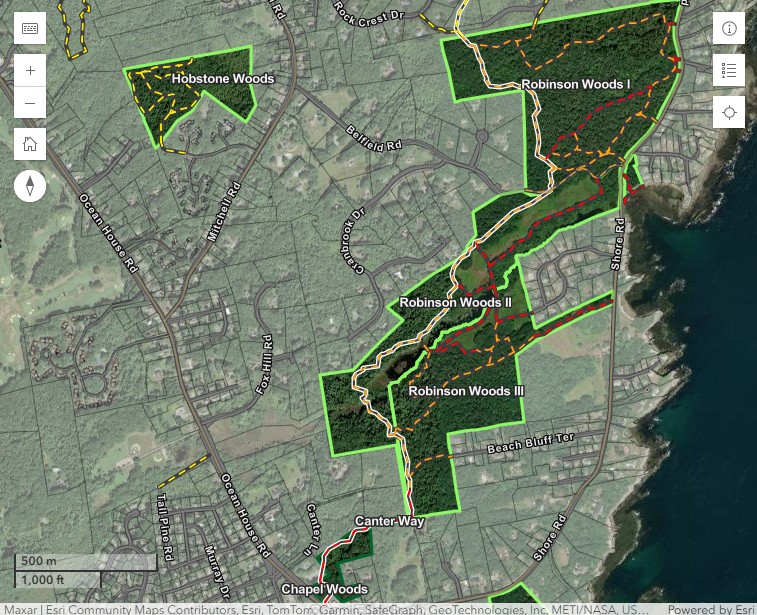
There is now an interactive CELT web map available that shows public trails and the properties across town protected by CELT.
Interested trail visitors can open this map on any device to see their location, see what public trails are nearby and how they connect, and learn about the protected areas spanning across Cape Elizabeth, Maine.
We hope these maps can help spread the word about public trails that are available across Cape Elizabeth! Take a look and certainly let us know any feedback you may have, either with this online survey form or by emailing us at info@capelandtrust.org. The data is dynamic, and we will strive to keep it updated in real time. Thanks and enjoy the trails!
About the Map
This project began in 2024, when our summer stewardship assistant Elsie McCarthy chose to focus on ArcGIS Online web maps for her end-of-summer project. Using the existing parcel and trail data that CELT had been working with internally, she formatted informational pop-up windows to show pictures, descriptions, and trail features. These displays connect directly to the source material, which means that as trails are rerouted or new properties are protected, the web display will update automatically.
Over the winter, we worked to update the parcel and trail data to more accurately show the opportunities for public access that we could then communicate with the wider community.
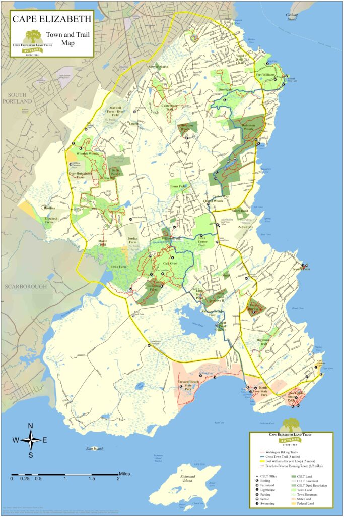
We then updated the Town & Trails map pdf to reflect new trails, re-routed trails, and newly protected properties since the previous 2021 CELT map pdf. This 2025 CELT map pdf is available on our website and is on display at the CELT office. It shows rerouted trails and new properties that have been protected since 2021, including Chapel Woods and the Davis Parcel.
Finally this spring, we formatted the web map overall visuals, data displayed, and informational pop-ups to be more user-friendly.
The Town of Cape Elizabeth has a similar map on their website, which can be referenced to confirm public access specifics for areas they manage, including Gull Crest and Winnick Woods. We have also been working to update the open-source trail data of OpenStreetMap (OSM), which is used by popular navigation apps such as Strava and AllTrails. Our hope is to update the data source to show which trails indeed have official public access, which old pathways no longer exist, and where there are newly-built trails that visitors can explore.
Let us know how your web map experience goes, and may this be a fun excuse to visit a trail this beautiful season in Cape Elizabeth.